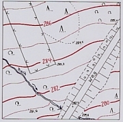
Topographial plans show an exact image
of the surface of the earth, altitudes by
means of altitude codes and altitude
lines includet.
Detailed plans, containing the elevations
of ground, are practically necessary for
all planing of construction. So they serve
among others as a base for the calcula-
tion of earthmasses; for the communal
administration of graveyards; for the
documentation of the exploitation of
material of quarries; for the planing of
projects of landscape architects, etc.